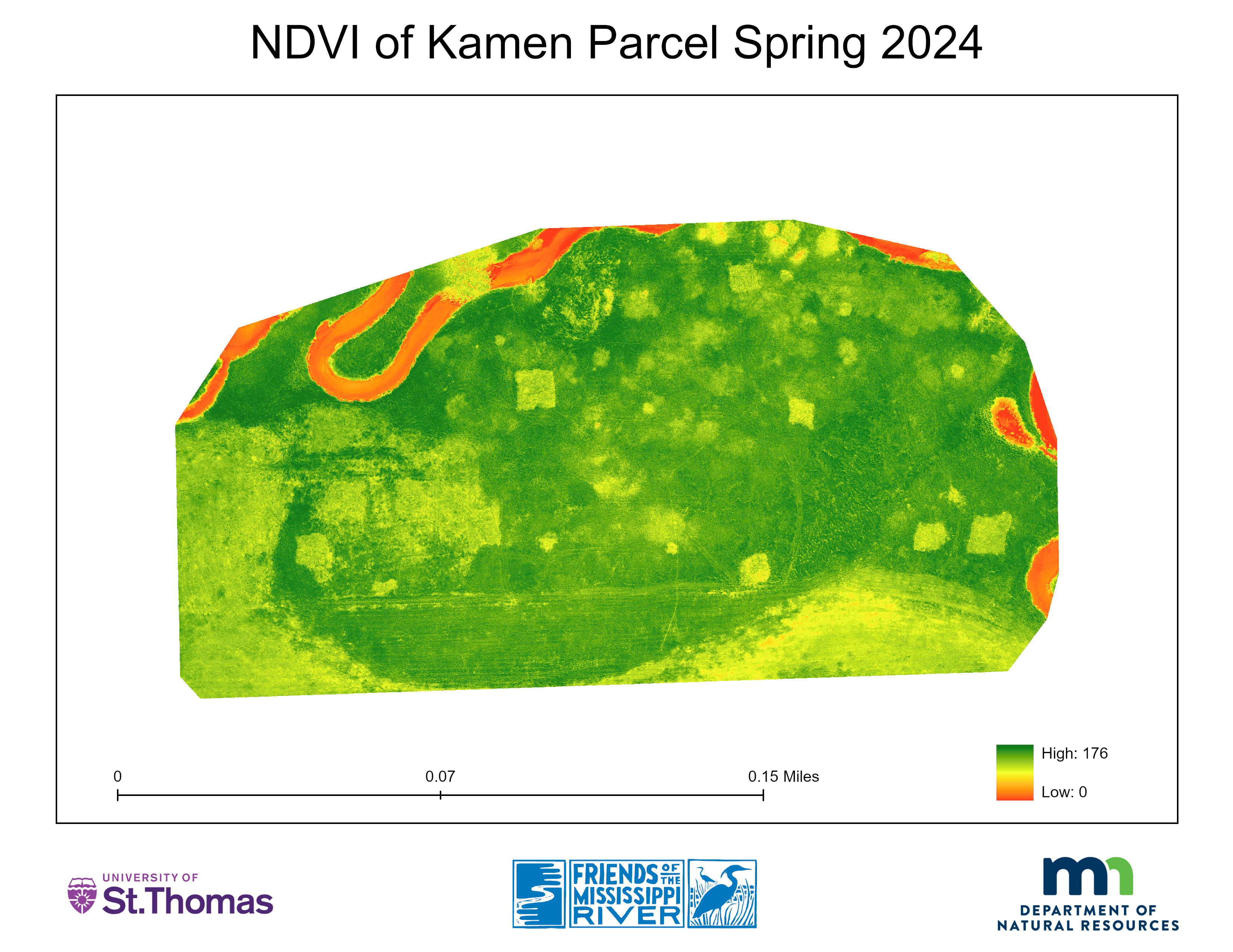
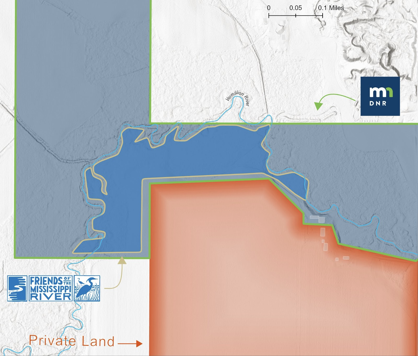
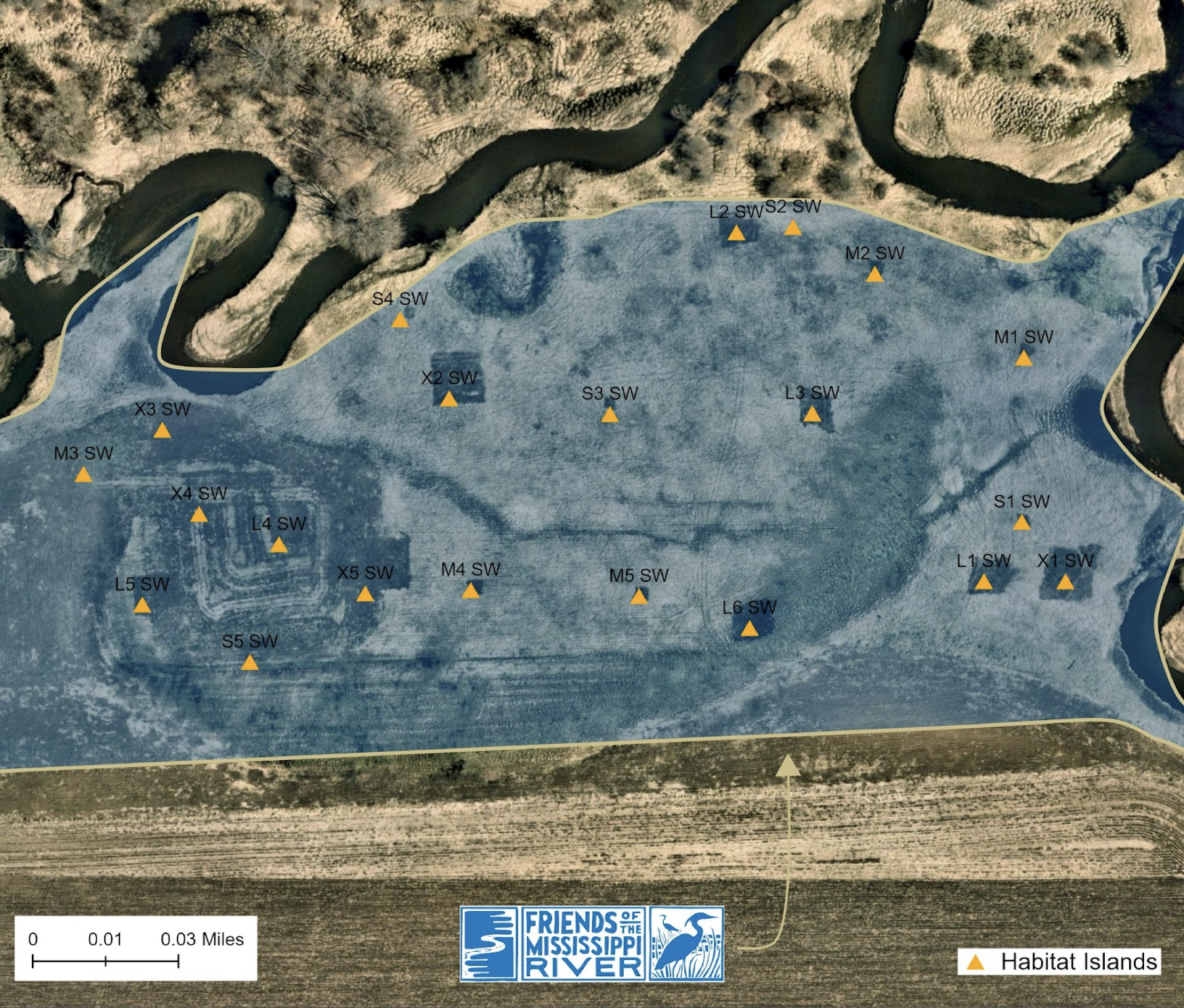
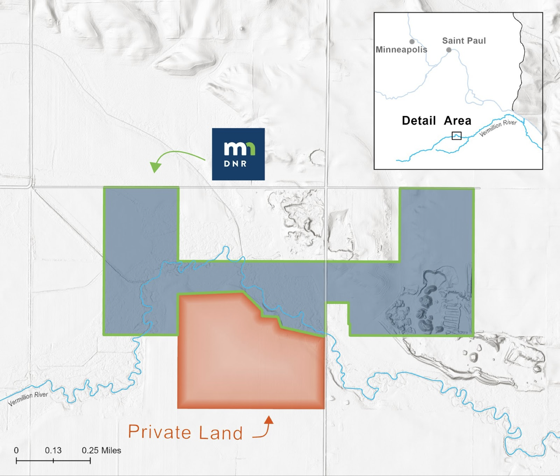
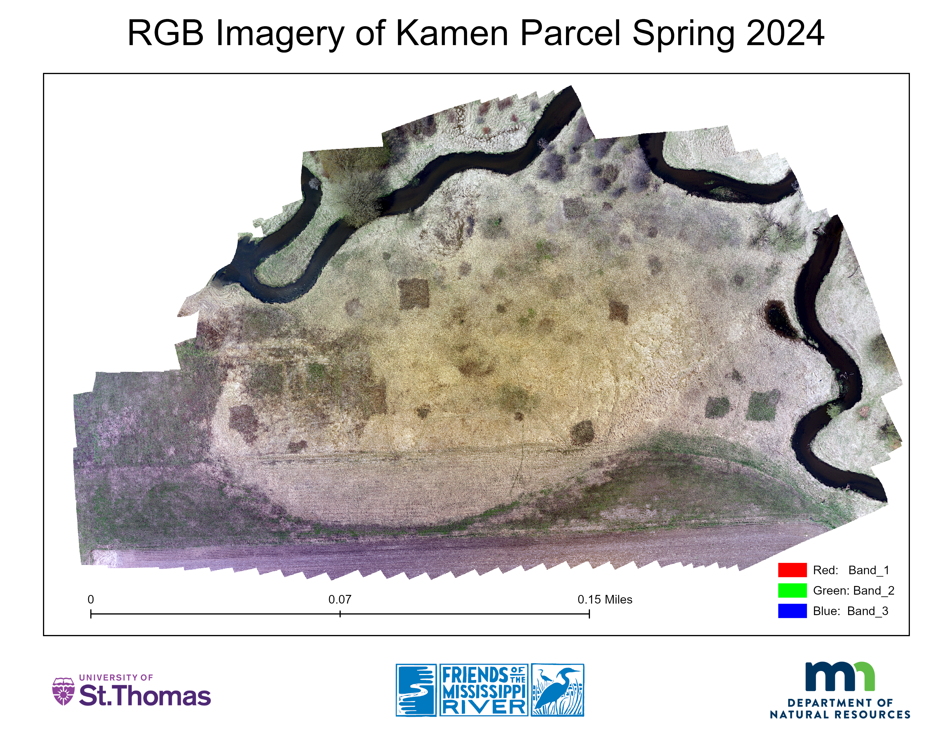
Monitoring a Novel Landscape Restoration project along the Vermilion River using Unoccupied Aerial Vehicles (UAVs)
Leading UAV research in partnership with Minnesota DNR and Friends of the Mississippi River. View Project Scope
UAVs, Cartography, Field Data Collection
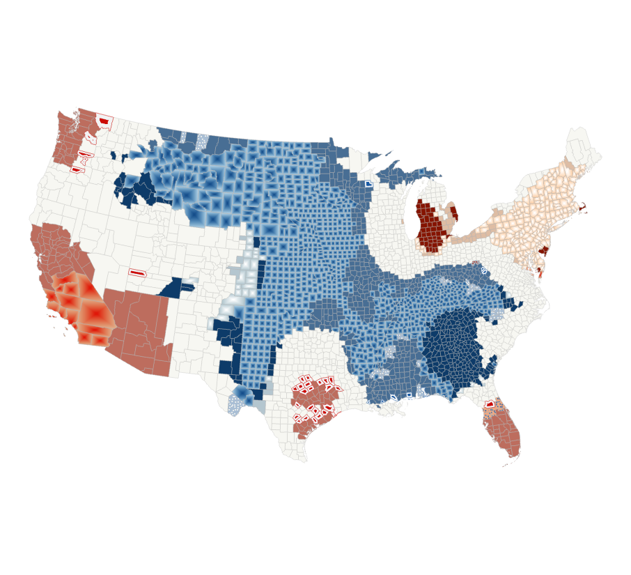
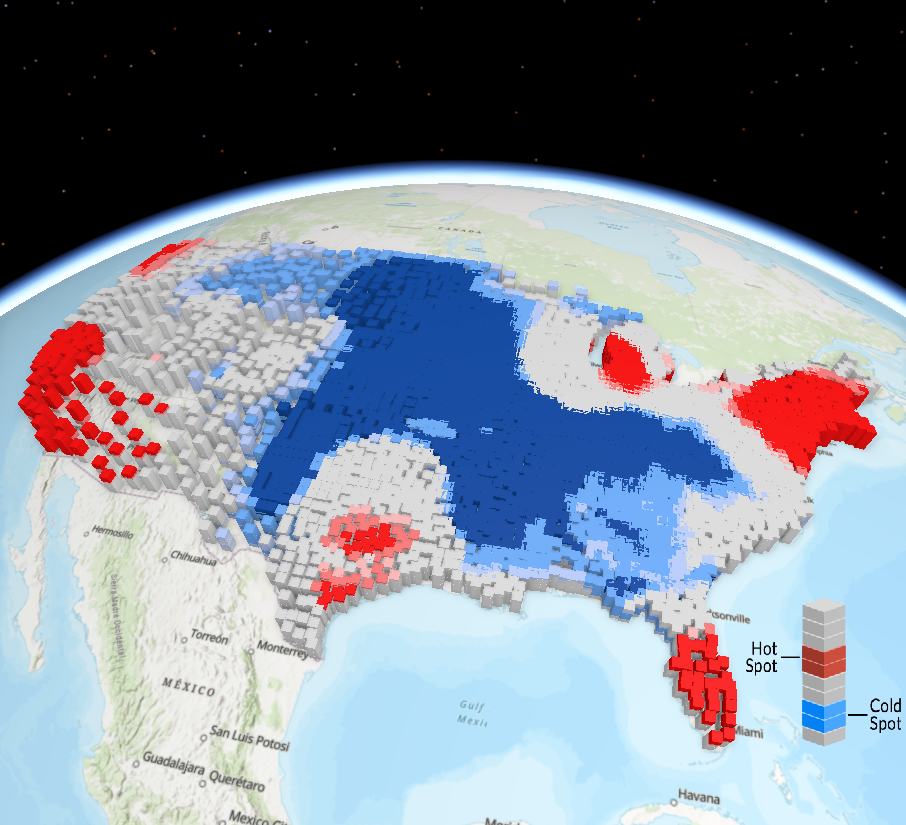
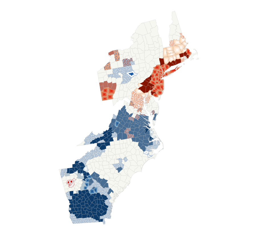
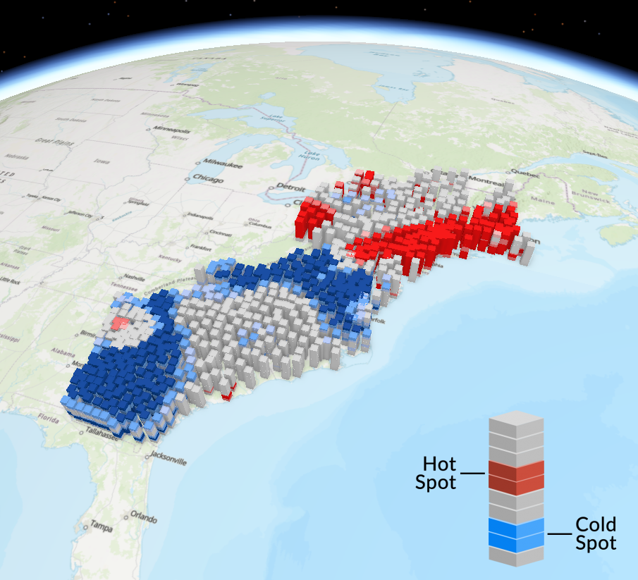
Emerging Hot Spot Analysis of a United States Population Space-Time Cube
Using an emerging hot spot analysis of United States population data to understand historical and emerging population trends across the United States. Presented at The GIS/LIS Conference 2023, View Presentation Slides
3D Analysis, Data Management, Public Speaking
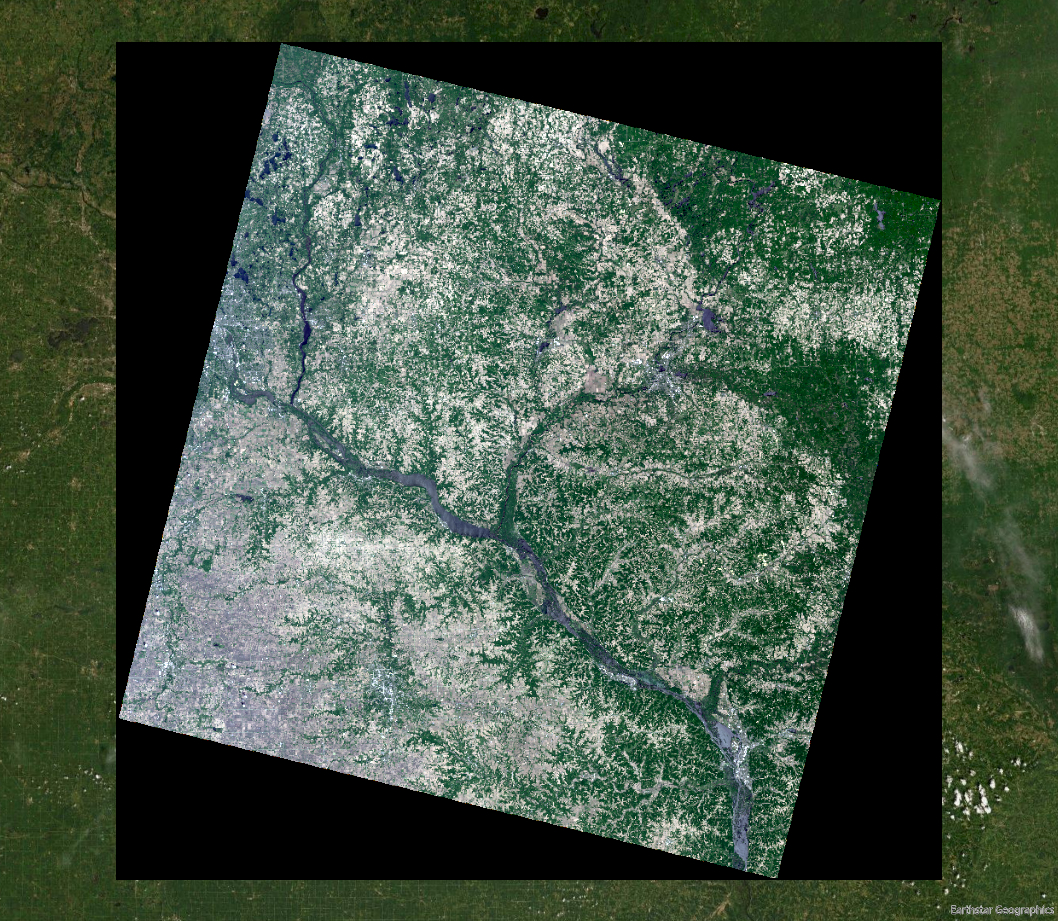
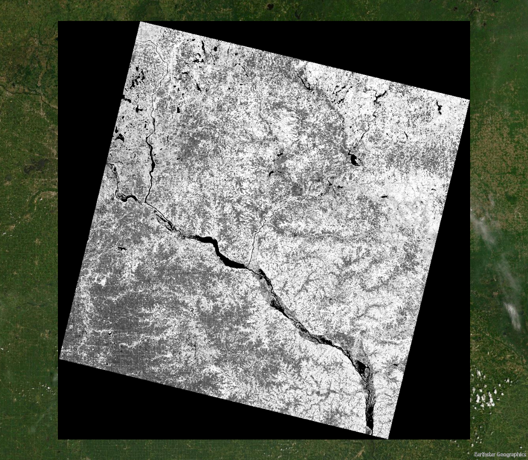
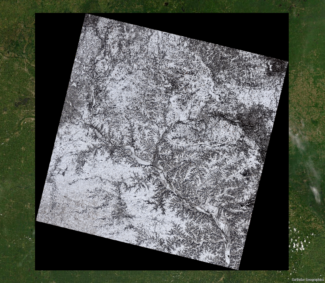
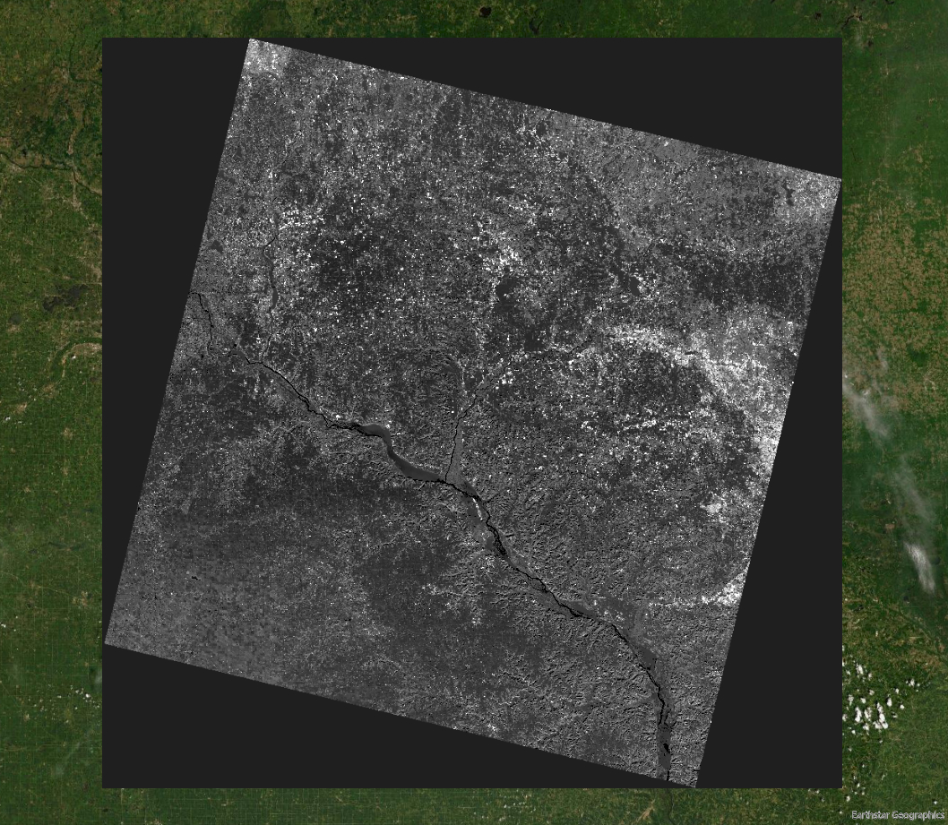
Publicly Accessible Morel Growth Locations in Winona County
Identifying potential locations of Morel mushroom growth using remote sensing techniques. View StoryMap
Remote Sensing, GIS, ArcGIS Pro
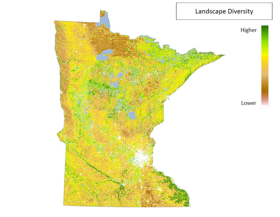
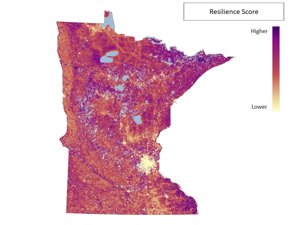
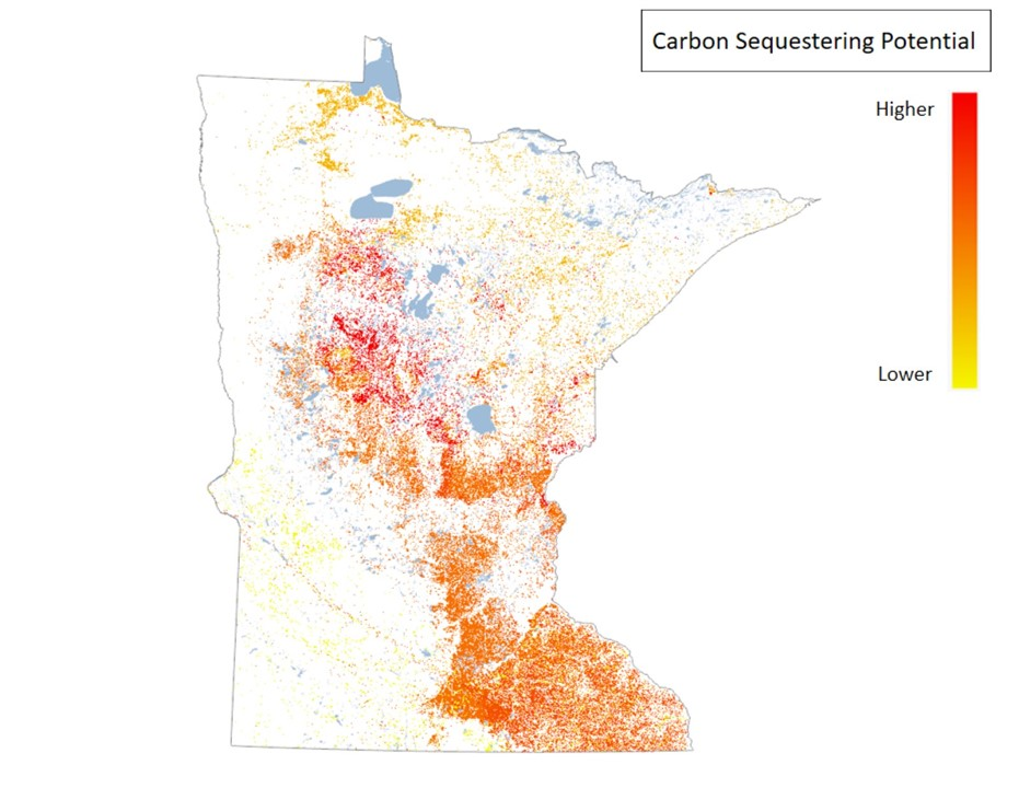
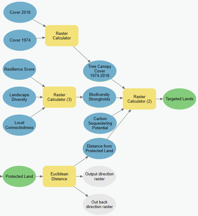
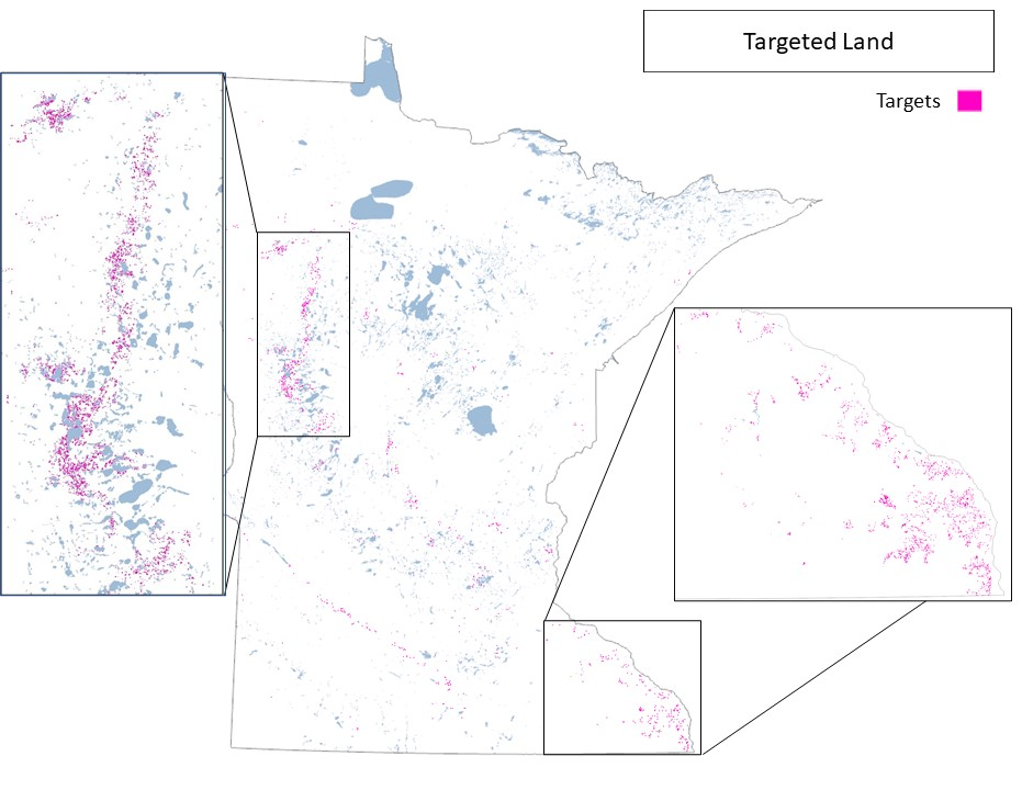
Multifunctional Forestation of Minnesota
Mapping Minnesota's forestry to determine where to plant trees for versatile foresting. View StoryMap
GIS, Cartography, ArcGIS Pro
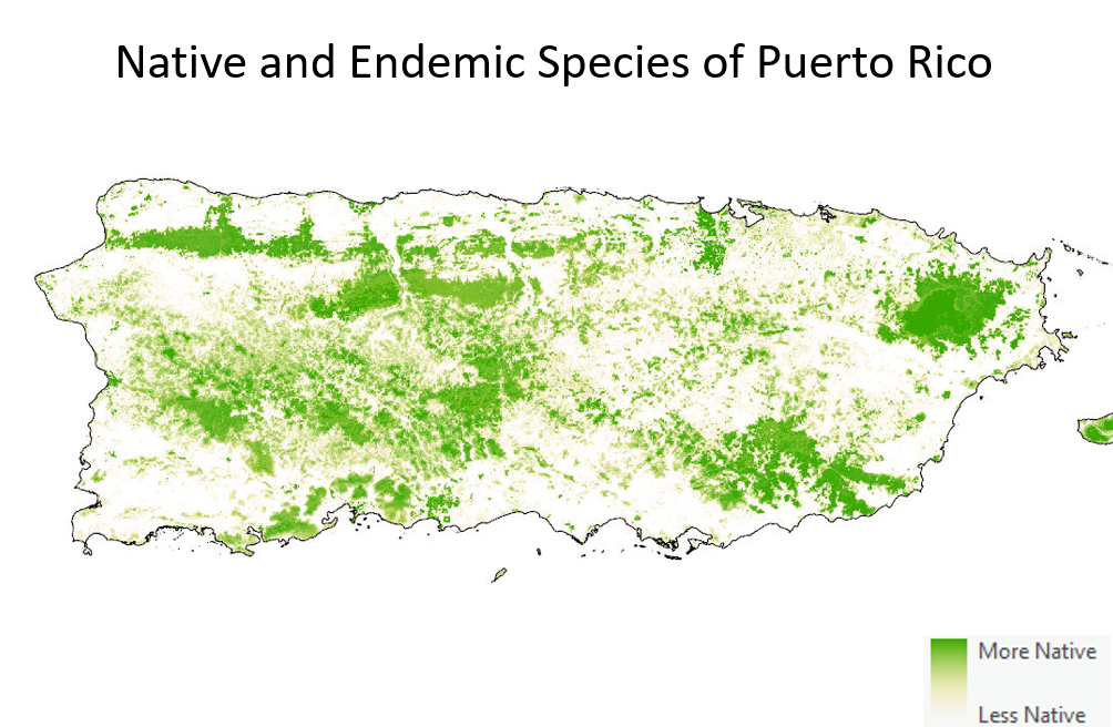
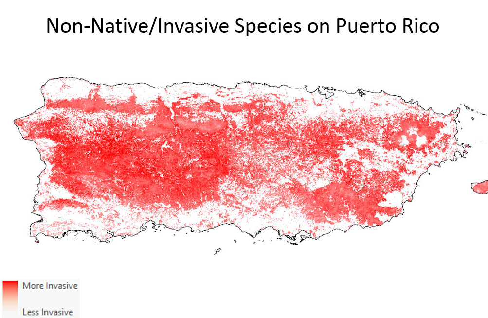
Conservation of an Anthropogenically modified Puerto Rico
Puerto Rico has an abundance of invasive tree species. Combating these invasives would require an exuberant amount of resources, instead could Puerto Rico embrace invasive trees while still protecting endemic trees? Presented at The MUGS Conference 2022
GIS, Cartography, Public Speaking
Assorted Cartography
Miscellaneous cartographic work for various projects.
GIS, Cartography